Suitability Analysis and Weighted Overlay Exercise
Problem: Using available data about stream, roads, trails, vegetation, and elevation within a park, biologists would like to know suitable areas to relocate bears to reduce the chances of bear interactions with park visitors.
Analysis and Procedures:
Model Builder replaces the standard workflow diagram for this exercise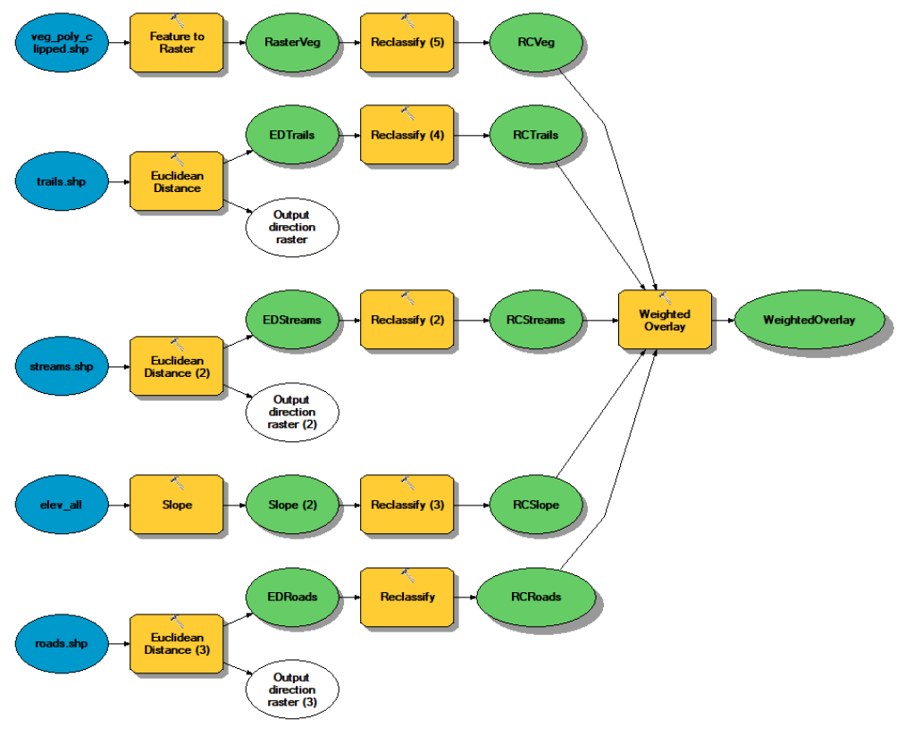
To solve this problem I used model builder in ARCGIS. Within Model builder, the general plan to solving the problem was to first create a geodatabase for the work environment, import the necessary layers into ARCmap, set the environment parameters, and then develop the model. Within the model I used various tools (outlined in the next section) to calculate the parameters needed, then reclassified those layers to perform a weighted overlay. The data sources used to solve the problem were the vegetation layer of the park, streams, roads, trails, and an elevation raster layer.
The detailed approach to solving this problem was to first add all the necessary layers to Arcmap, create a geodata base and then set my processing extent to the park boundary and the cell size to the same size as the elevation raster (30m) within my environments. From there I could create a toolbox and then a model. In the model I added all my layers. I used the slop tool to calculate the slope from elevation. I used feature to raster to convert the vegetation to a raster file. Then then used Euclidian distance to create a raster and calculate distance from each of my road, trail, and stream features. I then used reclassify on each of the new layers to sort the data in each raster into three categories. For the layers using Euclidean Distance, one mile was represented as 1609.344m. Three represented the most favorable category and one represented the least favorable. Once the layers were reclassified I could run the weighted overlay tool with each raster layer having equal weight.
Results:
Map depicts most favorable location for bear relocation. Least suitable areas were minimal and therefore not visible on the map.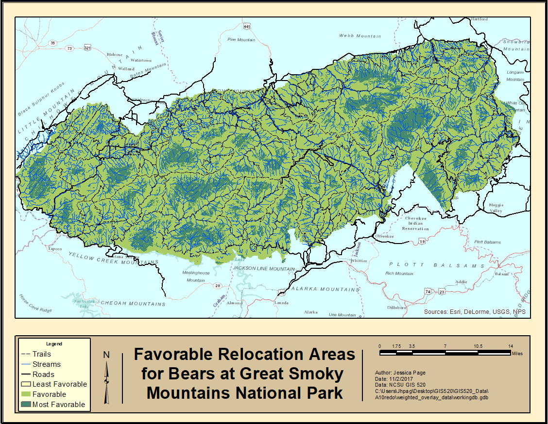
Application and Reflection: This was by far the most relevant, (and perhaps most frustrating) tool to use. Weighted Overlay can involve very complicated models to solve problems, each step of which needs to be thoroughly vetted. Weighted overlay is used to find suitable areas based on a variety of criteria whose impact may or may not vary. A common use of this is in wildlife habitat selection (although fuzzy overlay may be more appropriate) or site selection for something such as a playground.
Problem: A scenario for using this tool would be selecting the sites for oyster bed establishment in marshes in southeastern North Carolina.
Data Needed: Much of the location data may need to be collected through field work. You could use weighted criteria such as proximity to already established beds mapped through field work, erosion rates using measurements that would need to be collected over the course of multiple seasons, and need for establishment based on water quality.
Analysis Procedure: The same general procedures used in this assignment could then be applied to this problem. Although the oysters are considered wildlife, the criteria for areas that would need oyster bed establishment are not varying.
Additional Recommended Resources courtesy of ESRI:
<Back to Raster Data- Site Selection Forward to Image Classification>