Geocoding Tabular Data
Problem: A local business in Raleigh is seeking to improve their marketing campaign to reach potential customers in unrepresented areas. To assist us in our analysis the business has provided us the locations of their current customers.
Analysis Procedures: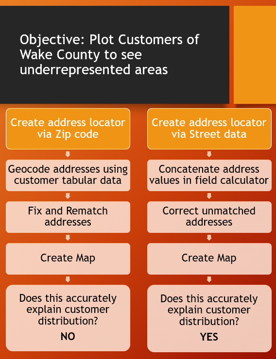
To solve this problem we will need to plot the locations of current customers on a map of Wake County. The business has provided an excel sheet of the customer addresses. We will use Geolocation in ARCMap version 10.5 and shape files of Wake County, Wake County Zip Codes, and the Wake County Streets which are available on their website to plot these addresses and see what areas are underrepresented on the map.
The first step is to geocode the data from the customer$ table using the Wake County zip code layer as the reference layer to see if this is an accurate representation of the customers in Wake County. Once data is Geocoded, some of the addresses must be corrected before creating a finished map. Once we geocode the addresses by zip code we see that this is not a good representation of our data so we continue to step 2. This is to geocode the addresses by street. When using our Create Address locator tool for our addresses we must use the field calculator tool to create a new field in our table and concatenate addresses to use US Address- Dual Ranges style. We can then Batch Geocode using or new table created form the customer database file. Addresses could then be corrected and a new map made for the local business.
Results:
This first map shows the Wake County customers geocoded by zipcode. This map isn’t nearly as detailed nor does it give us any useful information.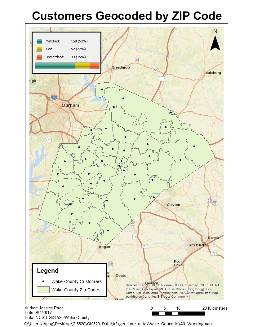
This map shows Wake county customer geocoded by street address, The map was enlarged for better visibility and you can get a sense of where customers are located and see empty areas.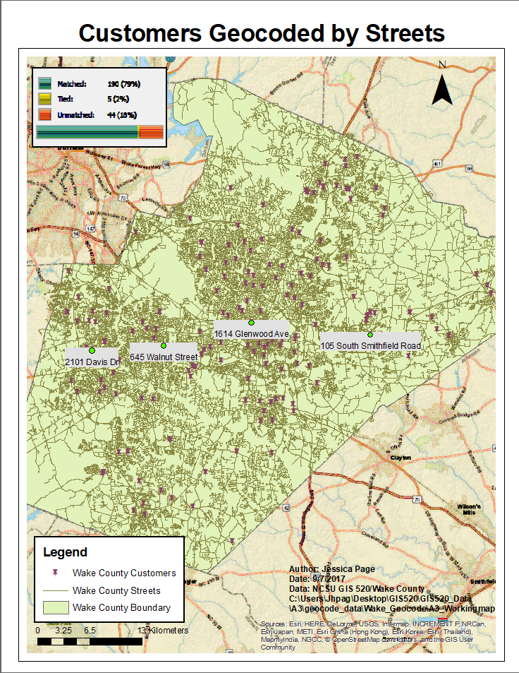
Application and Reflection: The concepts learned in this assignment could easily be applied to solve new problems. Geocoding is an essential skill for any organization that manages information based on address. This assignment also stressed the importance of checking unmatched geocoding data to better understand flaws in data transcription.
Problem Description: In another scenario we are trying to learn about the frequency and distribution of household food gardens in the city of Raleigh to assist in targeting outreach to communities and developing City programs to promote more household food gardens. Although this problem is not related to my thesis work, I have worked for the city as an educational programmer for the past two years and this is something I have proposed as potential course.
Data Needed: A census would need to be taken across Raleigh to create tabular data of those addresses. We could also further analyze that data with information such as household incomes in sections of Raleigh, average lot size to better understand our data and cater to those communities. The latter data would come from the US census service and location date is available through Wake County.
Analysis Procedures: The analysis procedures used to solve this problem would be nearly identical to the procedures used to solve the first problem. Census data would need to be geocoded to the locations to the street addresses. Further analysis can and should be done using cluster analysis procedure used in modules at later dates.
Additional Resources from ESRI: