AutoCAD Integration Exercise
Problem: A geodatabase must be created for the future management of campus building and facilities. This must be done using a provided CAD file and a provided orthophoto from 1999.
Analysis Procedures: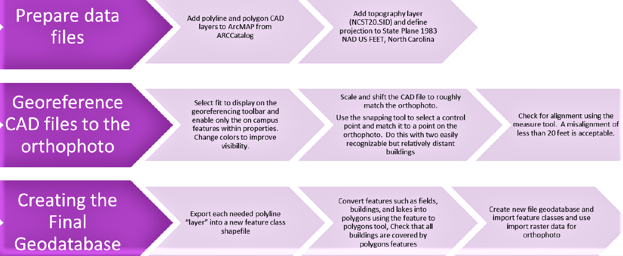
To solve this problem I needed to use my ArcMap version 10.5 with the georeferencing toolbar to georeference the provided CAD layer to the 1999 orthophoto of campus and then export the necessary feature layers to separate feature classes. Data was acquired through the NCSU GIS 520 course but may be available directly through NCSU.
To complete this assignment I first added my Polyline and Polygon CAD files. Then, to define the projection I added my raster and defined my projection to be State Plane NAD- US FEET North Carolina. To simplify the map I turned on only the layers that I need within the CAD under the symbology tab. I then aligned my CAD file to the othrophoto through the Georeferencing toolbar by using fit to display, shift, scale, and snapping tools. Then I used the select by attribute tool to convert campus feature into individual feature classes. I then used the feature class to polygon tool to convert lake, building, and field outlines into closed polygons. This also solved the issue that some of the buildings were not showing up as closed polygons in the CAD file. To package my assignment, I then created a file geodatabase and used import feature class and import raster to add the necessary files to my geodatabase.
Results:
Orthophoto of campus with georeferenced master plan CAD file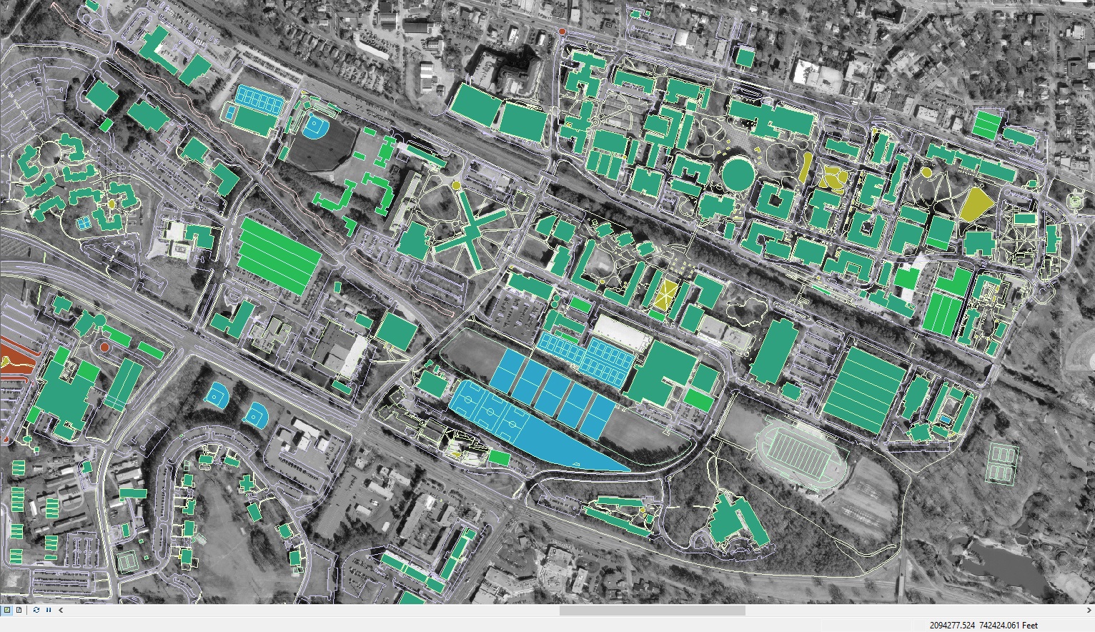
Application and Reflection: The skills learned in this assignment could certainly be applied when working with historical documents and older maps. A great example would be if you seeking to compare something such as change in the landscape and development over the course of many years through older drafted maps. If those maps are put into ArcMap using CAD one could overlay and compare these maps to get a more quantitative assessment of change.
Problem Description: A non-profit conservancy would like you to create a geodatabase of natural features and buildings around its campus as it is preparing projects for interns in the next summer.
Data Needed: To solve this problem you will need an orthophoto and current CAD map of the conservancy campus. If the CAD is not available it is possible to create these features manually. However, this is not cover in this section.
Analysis Procedures: The geodatabase will be created through using the georeferencing toolbar and carefully aligning features based on building corners.
Additional Resources from ESRI: