Problem: In this exercise I need to create land cover data for the Black Water Wildlife Refuge using aerial photographs in 4-band format.
Analysis Procedures: 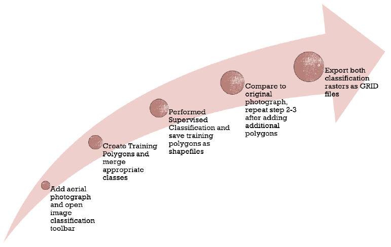
To solve this problem requires use of ARCmap and knowledge of NLCD classification legend. After enabling the “Spatial Analyst” extension I used the “Image Classification” toolbar to perform a “Supervised Classification”.
The approach to solving this problem is to first add the aerial photograph as a group. I then enabled the Spatial Analyst tool and added the image classification toolbar. Using the image classification toolbar, I created training sample polygons by opening the training sample manager, drawing polygons within each class, merging similar polygons, and repeating for each of the six classes which were then formatted. I then performed a supervised classification and saved the training polygons as a shapefile. I then noted areas that were classified wrong and added additional training polygons to create a second land classification layer. The new set of polygons was saved and both classification layers were exported as GRID files so that area could be classified.
Results:
Map display of the initial sample polygons drawn for image classification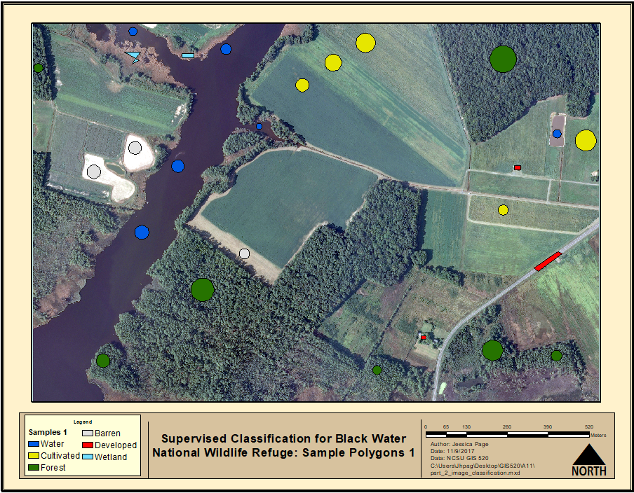
Image classification results for first set of sample polygons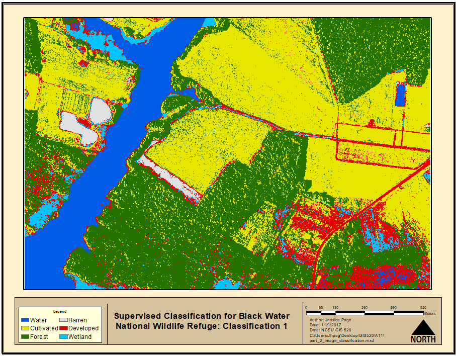
Map of sample polygons with additional polygons drawn for image classification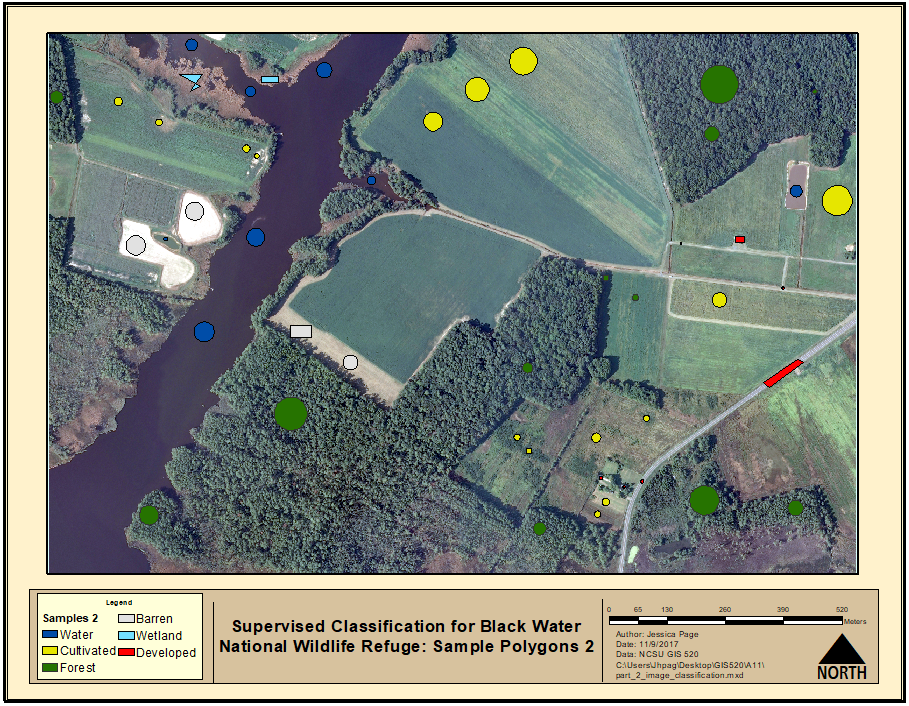
Image classification with additional sample polygons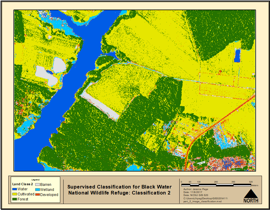
Application & Reflection: While the nlcd dataset is the best available tool for assessing land cover on a large scale it may not be as useful for landcover on a very fine scale. Image classification can be used to classify those landcover types on finer scales for ecological research.
Problem Description: This tool would be particularly useful for a biologist that wishes to map specific habitat types and examine their change over time in a remote location that is not accessible by foot, for example, they would like to assess erosion and change in parts of the everglades that are not easily accessible. He is particularly interested in identifying and quantifying potential bird habitat for the mangrove cuckoo.
Data Needed: The biologist would need access to a drone or other means and an ability to take a 4-band aerial photograph. The biologist would also need to be able to differentiate between specific vegetation structures.
Analysis Procedures: In the scenario the biologist would like to classify his study area based on Paul Hamil’s 1992 land cover classifications types for a more specific approach to identifying habitat. Using sample polygons we would identify and classify different vegetation types and repeat until the classification map is correct. Errors due to shadows or general classifications within the software would then be fixed manually.
Additional resources:
<Go Back to Site Suitability Analysis Go Forward to Customizing ArcMap>